|
These maps
are examples of the demographic-data mapping capability of Microsoft
MapPoint� version 2002.
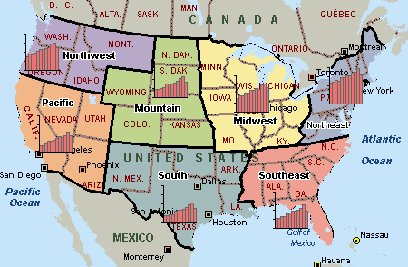
Territory Planner
This map of the United States is overlaid
with seven custom territories.
Drivetime Zones
This map of the United States illustrates
30-, 45-, and 60-minute drivetime zones from Chicago's O'Hare Airport,
represented by a custom pushpin.
Data Mapping with Shaded Regions
This map of the northeastern United States shades ZIP Code areas by
population estimates.
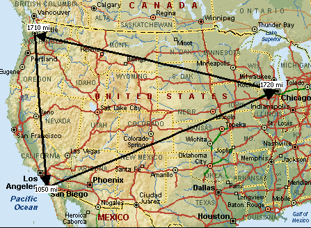
Flying Distances
This map of the United States shows flying
distances between Chicago, Seattle, and San Diego.
|